Backup PNT methods are essential for GPS-denied environments
StoryNovember 09, 2016


Backup methods of position, navigation, and timing (PNT) are essential for warfighters operating within GPS-denied environments. Warfighters rely on the U.S. NAVSTAR global positioning system (GPS) and global navigation satellite system (GNSS) for military operations, but are encountering an intense escalation of jamming and spoofing attacks.
For years, the military community has been on a quest to find backup methods to supplement GPS and enable operations to continue uninterrupted within GPS-denied environments. Many methods are being explored to provide assured PNT, and several options are emerging as quite promising.
GPS technology continues to evolve on other fronts, such as the push to M-Code (a restricted military signal) to improve security and antijamming of military navigation using GPS by 2018; the drive to reduce size, weight, power, and cost (SWaP-C); and combining GPS receivers with inertial measurement units (IMUs).
GPS-denied environments
The inability to receive GNSS signals can be caused by many factors – including inaccessible signals based on terrain, jamming, spoofing, or the not-so-likely event of catastrophic GNSS failure.
GPS jamming “involves interrupting the GNSS receiver with power, possibly intentionally or via vicarious interference, from other systems on the platform,” explains Peter Soar, business development manager for military and defense for NovAtel in Calgary, Alberta. “We know that jamming is being used aggressively in Ukraine and on the Korean peninsula on a daily basis. It’s also become a widespread nuisance through the use of cheap, openly available ‘personal protection jammers’ that are being misused.”
So how bad is the problem? For a little perspective, South Korea’s Ministry of Land, Infrastructure, and Transport reports that since 2010, GPS jamming believed to be the handiwork of North Korea has affected more than 2,100 planes. These malicious attacks cause cellphones to malfunction and can disrupt air traffic and ships that rely on GPS for navigation.
NATO is currently moving troops to the Baltic, and “undoubtedly anticipates being hit with high-power GPS jamming,” Soar notes. “Typical military jammers are able to affect your GPS receiver for many tens of kilometers by line of sight.”
NovAtel’s antijam technology, for example, is a null-forming system that preserves the antenna’s view of GPS satellites while ignoring jammers to ensure that the satellite signals to compute its precise position and time remain available. Significantly, it offers 40 dB of interference suppression, independent of the antijam performance of the rest of the system (receiver, etc.), which means that you can safely operate 100 times closer to a jammer than without it.
Beyond jamming, spoofing is another method to disrupt GPS. Spoofing involves deceiving a GNSS receiver with false signals, either rebroadcasting or generating them. “Clearly, the consequences of spoofing can be serious. But many technical barriers must be overcome to successful spoof a properly protected PNT system,” Soar says. “If you’re worried about being spoofed, at a minimum, use a keyed military receiver.”
Another way to make a spoofer’s job more difficult is to “combine more than one frequency with possibly more than one constellation, and SAASM [selective-availability anti-spoofing module] or M-Code,” Soar advises. “Or you can add a tightly coupled inertial navigation system, which can’t be spoofed.”
Unfortunately, it’s not always feasible to encrypt all systems. “Many military UAVs [unmanned aerial vehicles], for example, are flying hybrid systems to cut down on SWaP-C. They may use an SAASM receiver for general work and protection, but have other unencrypted receivers within the system,” Soar explains. “In this case, SAASM receivers are too expensive to be used throughout. And, until recently, you could only get six-meter resolution from a SAASM receiver, so they couldn’t provide the accuracy that you get from real-time kinematics.”
Now, NovAtel, Rockwell Collins, Geodetics, and TAG – all in their own unique ways – are making hybrid receivers with SAASM onboard that are capable of doing real-time kinematics, which is a technique used to enhance the precision of position data derived from satellite-based positioning systems.
“It’s interesting to note that we’ve had our product on the market for some years now, and uptake was steady until this year,” Soar says. “It now appears that someone within the DoD [Department of Defense] has put their foot down and said ‘You must stop flying with open signal receivers and get an SAASM.’ We’re seeing a huge upsurge of interest in SAASM and antijam.”
As far as catastrophic GNSS failure, while the likelihood is low, Soar points out that it can’t be ruled out. Thankfully, “the growth in GNSS constellations and their growing robustness is significant mitigation of total failure,” he adds.
IMUs as GPS backup
IMUs are receiving plenty of attention from the DoD as a solid backup solution for GPS-denied environments.
Honeywell Aerospace (Phoenix, Arizona) and Northrop Grumman are currently working with the U.S. Defense Advanced Research Projects Agency (DARPA) on its Precise Robust Inertial Guidance for Munitions (PRIGM): Navigation-Grade Inertial Measurement Unit (NGIMU) program to further develop advanced IMUs.
The goal of the PRIGM/NGIMU project is to “develop a MEMS [microelectromechanical system]-based navigation-grade IMU that has a mechanical/electronic interface compatible with a drop-in replacement for existing tactical-grade IMUs on legacy DoD platforms,” explains Dr. Robert Lutwak, program manager for DARPA’s Microsystems Technology Office.
The PRIGM program also entails “basic research efforts for advanced inertial micro sensors (AIMS),” Lutwak continues. “PRIGM/AIMS explores alternative technologies and modalities for inertial sensing – including photonic and MEMS-photonic integration, as well as novel architectures and materials systems.”
Ultimately, PRIGM/NGIMU is expected to “identify promising candidate technologies for further development as high-performance inertial sensors for long-duration missions and deployment in extreme environments,” Lutwak says.
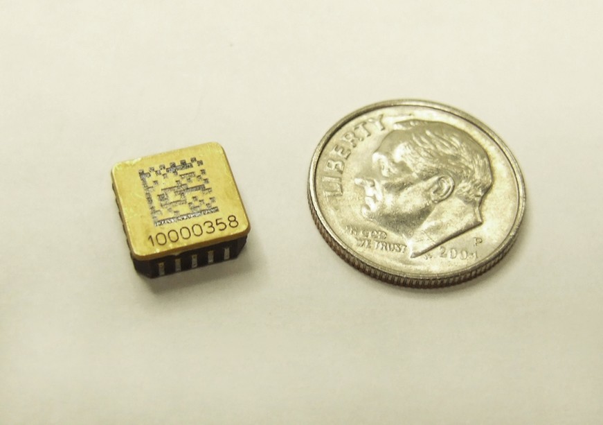
As part of this effort, Honeywell is working to improve the performance of its MEMS HG1930 IMU by three orders of magnitude while maintaining its size, weight, and power consumption (Figure 1).
Figure 1: Pictured here is a Honeywell packaged MEMS gyro sensor.
|
|
“GNSS is an outstanding aiding source when it’s available, but it’s vulnerable to very-low-power signals,” says Chris Lund, director of product marketing for Honeywell Aerospace. “The more a platform relies on external signals, the more vulnerable it is to interruption. This is unacceptable for use cases that must always work, such as critical missions on the battlefield.”
That’s why solutions that don’t rely on GNSS signals, such as inertial sensors and non-GNSS aiding sources, are necessary to ensure continuous operation. “One of the primary benefits of inertial sensors is that they can’t be jammed or spoofed because they don’t rely on external information,” Lund adds. “Further, if a platform can leverage the hardware that’s already on board, such as altimeters and cameras, alternative navigation techniques can be used with only a software update.”
Other GPS backup alternatives
Many GPS-denied backups are currently being explored, including but not limited to TIMUs, eLoran, EPLRS, non-GPS-based positioning, and quantum IMUs.
Honeywell, for its part, is “working on numerous alternatives to GNSS aiding, including vision aiding, collaborative aiding, celestial aiding, terrain-aided navigation, and using signals of opportunity,” Lund says. “All of this is aimed at allowing our customers to continue to operate without any degradation in performance – even if GNSS signals aren’t available.”
- TIMUs
DARPA is working on tiny timing and inertial measurement units (TIMUs) for backup to GPS in applications including personnel tracking, handheld navigation, small-diameter munitions, and small airborne platforms.
“Our goal for TIMUs is to develop a tactical-grade IMU based on MEMS technology, including simultaneous cofabrication of three gyroscopes and three accelerometers with unprecedented SWaP-C gains,” Lutwak says. “As our TIMU efforts wind down, DARPA is working with other DoD entities to transition the technology.”
- eLoran
Congress recently passed a bill to explore building an alternative to GPS, which might involve reinstating the eLoran network. The original Loran-C navigation system was decommissioned in North America in 2010, so an enhanced system such as eLoran would be an intriguing advance because its signals, unlike GPS, can reach underground, underwater, and inside buildings.
“Although it doesn’t provide altitude measurements of anything like the accuracy of GPS, eLoran would be a good complement capability for GPS because it’s very difficult to jam,” Soar notes.
- EPLRS
The U.S. and Canadian armies are using the Enhanced Position Locating & Recording System (EPLRS), a secure, jam-resistant computer-controlled communications network.
“It’s essentially a data radio hooked up to GPS receivers,” Soar explains. “These systems constantly send status messages back and forth with position data. If you get jammed, you can use the time-distance-arrival technique on the communications signal between EPLRS stations … and if you’ve got two, three, or more, you can triangulate. But this method is fairly coarse and intended for backup.”
- Non-GPS-based positioning
Australia-based Locata Corp. engineers developed a non-GPS-based positioning system that has been installed at the U.S. Air Force’s White Sands Missile Range in New Mexico. It’s proven capable of providing “reference truth” positioning across the vast area of White Sands when GPS is being completely jammed.
How does it work? Locata’s completely autonomous positioning technology creates terrestrial networks that function as a “local ground-based replica” of GPS-style positioning. It’s important to note that this technology isn’t intended as a GPS replacement, but rather to provide a local extension and expansion of GPS. It works with GPS but can also operate independently when GPS isn’t robust or is completely unavailable.
Instead of relying upon orbiting satellites, LocataNet taps a network of small, ground-based transmitters that blanket a chosen area with strong radio-positioning signals. Since it’s terrestrially based and provides powerful signals, Locata’s technology works in any internal or external environment.
- Quantum IMUs
Atomic or “quantum” IMUs are probably on the horizon, though likely still years out and classified.
Honeywell is working on “atomic inertial sensors” that are in early stages. “This class of devices uses atoms as the inertial sensor and has the potential to provide amazingly high performance within an extremely small package,” Lund notes.
NovAtel builds and designs GPS and GNSS receivers, and uses the best-of-breed IMUs from across the industry. “I can tell you that we put a lot of work into researching IMUs, but we’re not working on quantum IMUs yet,” Soar says. “If they were ready, we’d know.”
Back to basics
At this point, we may also see a return to the basic navigation methods. “Soldiers tend not to know how to map-read as well as they used to,” Soar says. “Now, many countries are addressing this problem. The U.S. Navy announced last year that it’s reintroducing teaching on sextants. So ... right back to old-fashioned ship navigation – you can’t jam it.”
The bottom line, as Soar is quick to point out, is that “currently there’s nothing quite like GPS/GNSS for accuracy, persistence, and worldwide availability. If alternatives were up to it, we’d use them … but they’re not ready.”